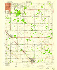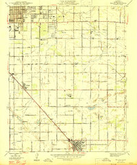
1947 Map of Malaga
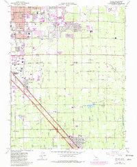
USGS Topo · Published 1947About this map
Vineyards and irrigation networks define the landscape south of Fresno just after the mid-century, where the Alta Vineyards Mattei Plant stands as a focal point for the region's agricultural industry. The land is precisely partitioned by a grid of namesake roads and an intricate system of waterways, including the Fresno Canal, Central Canal, and Malaga Canal, which sustain the productive valley floor. Small community centers such as Malaga and Calwa are situated along the Southern Pacific and Atchison Topeka and Santa Fe rail lines, which serve as the primary conduits for local commerce and transport.
Find a feature on this map
63 named features on this map. Tap any name to fly to it.
Don’t see what you’re looking for? This feature index may not catch every label — zoom into the map to look around manually.
Map Details
Editions of this 1947 Malaga Map
This is the sole edition of this map. No revisions or reprints were ever made.
Historical Maps of Fresno Through Time
8 maps found