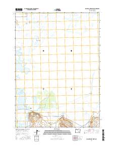
2017 Map of Malheur Lake West
USGS Topo · Published 2017About this map
Malheur Lake and its intricate shoreline dominate this portion of Harney County, where the high desert meets a complex wetland system. The settlement of Voltage sits at a crossroads south of the lake, marking a hub of activity near the Blitzen Valley. This landscape is defined by the hydrologic connection between the Donner und Blitzen River and the shallow lake basin, creating a sanctuary of marshlands and springs. Notable features such as Sodhouse Spring and Indian Spring highlight the critical role of freshwater sources in this arid region. Roads like the Narrows-Princeton Rd and Sodhouse Ln trace the perimeter of the wetlands, providing access to landmarks like Graves Island and Cole Island, which rise from the surrounding waters and seasonal marshes.
Find a feature on this map
18 named features on this map. Tap any name to fly to it.
Don’t see what you’re looking for? This feature index may not catch every label — zoom into the map to look around manually.
Map Details
Editions of this 2017 Malheur Lake West Map
This is the sole edition of this map. No revisions or reprints were ever made.
Other maps of this area

1955 · Burns
USGS Topo · 1:250,000

1958 · Burns
USGS Topo · 1:250,000

1959 · Burns
USGS Topo · 1:250,000

1959 · Lawen
USGS Topo · 1:62,500

1960 · Crane
USGS Topo · 1:62,500

1967 · Coyote Buttes
USGS Topo · 1:24,000

1967 · Jackass Butte NE
USGS Topo · 1:24,000

1967 · Barton Lake
USGS Topo · 1:24,000

1978 · Malheur Lake
USGS Topo · 1:100,000
1990 · The Narrows
USGS Topo · 1:24,000