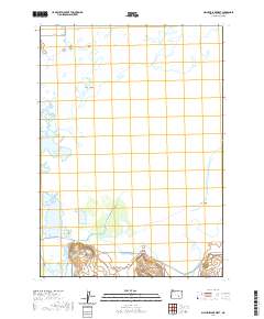
2020 Map of Malheur Lake West
USGS Topo · Published 2020About this map
Voltage serves as a lone settlement marker in this high desert wetland system where the Donner und Blitzen River and West Fork Silvies River empty into the expansive basin of Malheur Lake. The landscape is defined by the hydrologic shifts of the Blitzen Valley, where man-made features like Bull Ditch intersect with natural water sources such as Sodhouse Spring and Indian Spring. This 2020 survey illustrates the remote character of the Harney Basin, highlighting the isolation of named landforms like Graves Island and Cole Island within the marshy lakebed. The map also traces the foundational road network of the region, including Narrows-Princeton Rd and Center Patrol Rd, which provide essential access through the seasonal wetlands and alkali flats that characterize this part of southeastern Oregon.
Find a feature on this map
21 named features on this map. Tap any name to fly to it.
Don’t see what you’re looking for? This feature index may not catch every label — zoom into the map to look around manually.
Map Details
Editions of this 2020 Malheur Lake West Map
This is the sole edition of this map. No revisions or reprints were ever made.
Other maps of this area

1955 · Burns
USGS Topo · 1:250,000

1958 · Burns
USGS Topo · 1:250,000

1959 · Burns
USGS Topo · 1:250,000

1959 · Lawen
USGS Topo · 1:62,500

1960 · Crane
USGS Topo · 1:62,500

1967 · Coyote Buttes
USGS Topo · 1:24,000

1967 · Jackass Butte NE
USGS Topo · 1:24,000

1967 · Barton Lake
USGS Topo · 1:24,000

1978 · Malheur Lake
USGS Topo · 1:100,000
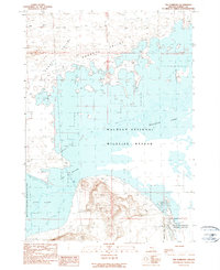
1990 · The Narrows
USGS Topo · 1:24,000