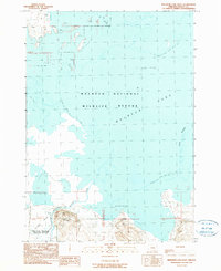
1990 Map of Malheur Lake West
USGS Topo · Published 1990About this map
Malheur National Wildlife Refuge dominates this landscape, showing the complex interplay between the seasonal waters of Malheur Lake and the marshlands fed by the Donner Und Blitzen River. This 1990 edition records a specific moment in the lake's fluctuating shoreline, capturing the marshy expanse between Voltage and Sod House. The human footprint is concentrated along the southern edge, where topographic elevations rise above the wetlands. Here, researchers can find the Sod House Sch and localized industry represented by a Cinder Pit and Gravel Pit. The map is particularly useful for understanding the hydraulic character of Harney County, illustrating how drainage patterns across Cole Island and various unnamed landforms were documented before modern environmental shifts further altered the basin.
Find a feature on this map
14 named features on this map. Tap any name to fly to it.
Don’t see what you’re looking for? This feature index may not catch every label — zoom into the map to look around manually.
Map Details
Editions of this 1990 Malheur Lake West Map
This is the sole edition of this map. No revisions or reprints were ever made.
Other maps of this area

1955 · Burns
USGS Topo · 1:250,000

1958 · Burns
USGS Topo · 1:250,000

1959 · Burns
USGS Topo · 1:250,000

1959 · Lawen
USGS Topo · 1:62,500

1960 · Crane
USGS Topo · 1:62,500

1967 · Coyote Buttes
USGS Topo · 1:24,000

1967 · Jackass Butte NE
USGS Topo · 1:24,000

1967 · Barton Lake
USGS Topo · 1:24,000

1978 · Malheur Lake
USGS Topo · 1:100,000
1990 · The Narrows
USGS Topo · 1:24,000