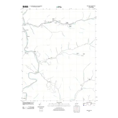
2011 Map of Mallory
USGS Topo · Published 2011About this map
The Guyandotte River and its major tributary, Huff Creek, carve deep valleys through this Logan County landscape, dictating the string-like arrangement of Appalachian coal towns. Communities such as Mallory, Mineral City, and Claypool are tightly clustered along the creek corridors, reflecting a settlement pattern driven by narrow flatlands and the requirements of valley-floor transportation. The map is a significant resource for genealogists, as it documents several family-named burial grounds, including the McDonald Cemetery and Browning Cemetery, alongside numerous local landmarks that served as community hubs.
Find a feature on this map
83 named features on this map. Tap any name to fly to it.
Don’t see what you’re looking for? This feature index may not catch every label — zoom into the map to look around manually.
Map Details
Editions of this 2011 Mallory Map
This is the sole edition of this map. No revisions or reprints were ever made.
Other maps of this area

1891 · Oceana
USGS Topo · 1:125,000

1893 · Oceana
USGS Topo · 1:125,000

1898 · Oceana
USGS Topo · 1:125,000

1909 · Gilbert
USGS Topo · 1:48,000

1910 · Pineville
USGS Topo · 1:48,000

1910 · Bald Knob
USGS Topo · 1:48,000

1912 · Bald Knob
USGS Topo · 1:62,500

1912 · Gilbert
USGS Topo · 1:62,500

1912 · Pineville
USGS Topo · 1:62,500

1913 · Logan
USGS Topo · 1:62,500