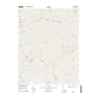
2014 Map of Mallory
USGS Topo · Published 2014About this map
Guyandotte River flows through this West Virginia coal country landscape, anchoring a series of small riverside and mountain-cleft settlements. The map shows the dense settlement patterns typical of Logan, Wyoming, and Mingo Counties, where communities like Mallory, Davin, and Accoville follow the winding paths of Buffalo Cr and other tributaries. Family history is etched into the terrain through numerous small burial grounds, including Claypool Cem and McDonald Cem, while the built environment is marked by local infrastructure such as the William C Browning Bridge near Verner.
Find a feature on this map
104 named features on this map. Tap any name to fly to it.
Don’t see what you’re looking for? This feature index may not catch every label — zoom into the map to look around manually.
Map Details
Editions of this 2014 Mallory Map
This is the sole edition of this map. No revisions or reprints were ever made.
Other maps of this area

1891 · Oceana
USGS Topo · 1:125,000

1893 · Oceana
USGS Topo · 1:125,000

1898 · Oceana
USGS Topo · 1:125,000

1909 · Gilbert
USGS Topo · 1:48,000

1910 · Pineville
USGS Topo · 1:48,000

1910 · Bald Knob
USGS Topo · 1:48,000

1912 · Bald Knob
USGS Topo · 1:62,500

1912 · Gilbert
USGS Topo · 1:62,500

1912 · Pineville
USGS Topo · 1:62,500

1913 · Logan
USGS Topo · 1:62,500