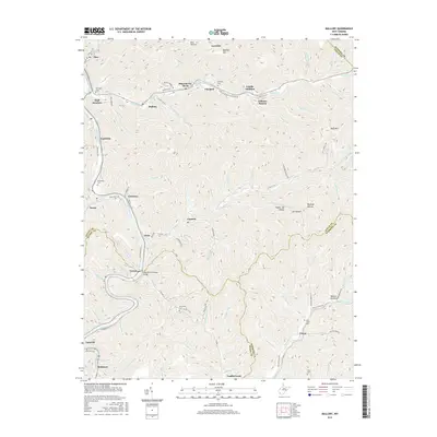
2016 Map of Mallory
USGS Topo · Published 2016About this map
The Guyandotte River snakes through this West Virginia mountain landscape, connecting a string of tight valley settlements at the junction of Logan, Wyoming, and Mingo counties. Steep ridges like Buffalo Mtn and Huff Mtn isolate the drainage basins of Huff Creek and Elk Cr, where residential enclaves such as Gillman Bottom and Combs Addition line the narrow valley floors. The distribution of family and community landmarks, including the William C. Browning Bridge near Verner and the McDonald Cem near Man, reflects a settlement pattern dictated by the vertical terrain. Genealogical interest is high here, with numerous burial sites like Claypool Cem and Browning Cem tucked into the hollows. The map illustrates the specialized infrastructure of coal country, showing the proximity of places like Mineral City and Mallory to the primary river and rail corridors.
Find a feature on this map
100 named features on this map. Tap any name to fly to it.
Don’t see what you’re looking for? This feature index may not catch every label — zoom into the map to look around manually.
Map Details
Editions of this 2016 Mallory Map
This is the sole edition of this map. No revisions or reprints were ever made.
Other maps of this area

1891 · Oceana
USGS Topo · 1:125,000

1893 · Oceana
USGS Topo · 1:125,000

1898 · Oceana
USGS Topo · 1:125,000

1909 · Gilbert
USGS Topo · 1:48,000

1910 · Pineville
USGS Topo · 1:48,000

1910 · Bald Knob
USGS Topo · 1:48,000

1912 · Bald Knob
USGS Topo · 1:62,500

1912 · Gilbert
USGS Topo · 1:62,500

1912 · Pineville
USGS Topo · 1:62,500

1913 · Logan
USGS Topo · 1:62,500