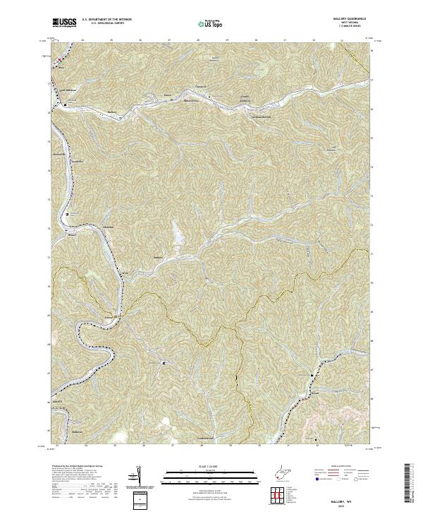
2023 Map of Mallory
USGS Topo · Published 2023About this map
The Guyandotte River carves through the heart of the southern West Virginia coalfields, where settlements like Man and Landville cling to the narrow valley floors. This 2023 survey illustrates the dense network of hollow-based communities typical of the region, including Mallory, Davin, and Mineral City along Huff Creek. The landscape is a complex intersection of three counties, with boundaries for Logan, Wyoming, and Mingo meeting amidst high peaks like Buffalo Mountain and Huff Mountain. Genealogists will find significant value in the mapped family and community burial grounds, such as McDonald Cem near Huff Junction and the remote Cline Cem in the southern reaches near Leatherwood. The map also captures several distinct residential pockets like Combs Addition and Gillman Bottom, reflecting the enduring post-industrial settlement patterns of the Appalachian interior.
Find a feature on this map
97 named features on this map. Tap any name to fly to it.
Don’t see what you’re looking for? This feature index may not catch every label — zoom into the map to look around manually.
Map Details
Editions of this 2023 Mallory Map
This is the sole edition of this map. No revisions or reprints were ever made.
Other maps of this area

1891 · Oceana
USGS Topo · 1:125,000

1893 · Oceana
USGS Topo · 1:125,000

1898 · Oceana
USGS Topo · 1:125,000

1909 · Gilbert
USGS Topo · 1:48,000

1910 · Pineville
USGS Topo · 1:48,000

1910 · Bald Knob
USGS Topo · 1:48,000

1912 · Bald Knob
USGS Topo · 1:62,500

1912 · Gilbert
USGS Topo · 1:62,500

1912 · Pineville
USGS Topo · 1:62,500

1913 · Logan
USGS Topo · 1:62,500