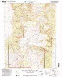
2001 Map of Malmsten Peak
USGS Topo · Published 2003About this map
Fishlake National Forest dominates this high-altitude landscape in central Utah, where the terrain is defined by the massive bulk of Forshea Mountain and the towering Malmsten Peak. The topography is a complex network of steep drainage systems, including Tibadore Canyon, Rock Canyon, and the appropriately named Hell Hole. Water management is central to the human footprint here, evidenced by numerous high-country catchments such as Tuft Reservoir, Pole Canyon Reservoir, and Rock Canyon Reservoir.
Find a feature on this map
38 named features on this map. Tap any name to fly to it.
Don’t see what you’re looking for? This feature index may not catch every label — zoom into the map to look around manually.
Map Details
Editions of this 2001 Malmsten Peak Map
This is the sole edition of this map. No revisions or reprints were ever made.
Other maps of this area

1885 · Beaver
USGS Topo · 1:250,000

1885 · Fish Lake
USGS Topo · 1:250,000

1896 · Fish Lake
USGS Topo · 1:250,000

1945 · Marysvale
USGS Topo · 1:62,500

1947 · Marysvale
USGS Topo · 1:62,500

1953 · Richfield
USGS Topo · 1:250,000

1956 · Salina
USGS Topo · 1:250,000

1958 · Richfield
USGS Topo · 1:250,000

1960 · Salina
USGS Topo · 1:250,000

1962 · Salina
USGS Topo · 1:250,000