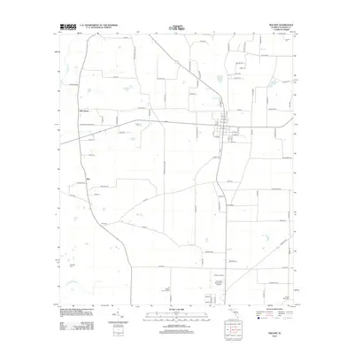
2012 Map of Malone
USGS Topo · Published 2012About this map
Agricultural lands and scattered aviation facilities define the landscape of Jackson County in the early 21st century. The map centers on the rural settlement of Ellis, where the local community is anchored by Ellis Church at the junction of several county roads. The region's geography is punctuated by numerous small basins and water bodies such as Boggy Pond, Williams Pond, and Goose Pond, while Cowarts Cr and Hays Spring Run drain the western reaches. For genealogists, the map is particularly valuable for its precise locations of family-oriented and community burial grounds, including Coonrod Cem, McNeally Cem, Hays Cem, and Nubbin Ridge Cem. An interesting concentration of small-scale aviation is evident in the southern portion of the sheet, featuring the Chipola Airpark, Acres Of Diamonds Airpark, and the J D Milton Farm Airport, suggesting a legacy of private and agricultural flight in this part of the Florida Panhandle.
Find a feature on this map
94 named features on this map. Tap any name to fly to it.
Don’t see what you’re looking for? This feature index may not catch every label — zoom into the map to look around manually.
Map Details
Editions of this 2012 Malone Map
This is the sole edition of this map. No revisions or reprints were ever made.
Other maps of this area

1952 · Dellwood
USGS Topo · 1:24,000

1952 · Cottondale East
USGS Topo · 1:24,000

1952 · Malone
USGS Topo · 1:24,000

1952 · Bascom
USGS Topo · 1:24,000

1952 · Sills
USGS Topo · 1:24,000

1952 · Marianna
USGS Topo · 1:24,000

1953 · Dothan
USGS Topo · 1:250,000

1954 · Dothan
USGS Topo · 1:250,000

1954 · Tallahassee
USGS Topo · 1:250,000

1955 · Dothan
USGS Topo · 1:250,000