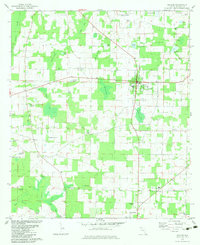
1982 Map of Malone
USGS Topo · Published 1983About this map
Malone serves as the primary hub in this portion of Jackson County, where a grid of rural roads connects several established community centers and local landmarks. The town of Greenwood anchors the southern portion of the sheet near Greenwood Airport, while the northern landscape is notably punctuated by a U. S. Coast Guard Station near the border with Alabama. The terrain is characterized by numerous small basins and named water bodies such as Jordan Bay, Hog Pen Pond, and Taylor Bay, suggesting a low-lying landscape where drainage patterns have shaped local land use and settlement.
Find a feature on this map
52 named features on this map. Tap any name to fly to it.
Don’t see what you’re looking for? This feature index may not catch every label — zoom into the map to look around manually.
Map Details
Editions of this 1982 Malone Map
This is the sole edition of this map. No revisions or reprints were ever made.
Other maps of this area

1952 · Dellwood
USGS Topo · 1:24,000

1952 · Cottondale East
USGS Topo · 1:24,000

1952 · Malone
USGS Topo · 1:24,000

1952 · Bascom
USGS Topo · 1:24,000

1952 · Sills
USGS Topo · 1:24,000

1952 · Marianna
USGS Topo · 1:24,000

1953 · Dothan
USGS Topo · 1:250,000

1954 · Dothan
USGS Topo · 1:250,000

1954 · Tallahassee
USGS Topo · 1:250,000

1955 · Dothan
USGS Topo · 1:250,000