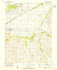
1953 Map of Malta Bend
USGS Topo · Published 1955About this map
Malta Bend serves as the focal point for this mid-century portrait of Saline County, Missouri, situated just south of the Missouri River and along the vital Missouri Pacific railroad line. The landscape is characterized by its drainage into the Salt Fork and Muddy Creek, reflecting a well-established rural community organized around traditional civic anchors. Genealogists will find a high concentration of burial grounds including Malta Bend Cem, Little Grove Cem, and St Marys Cem, alongside numerous country schools like Lincoln Sch and Central Sch that speak to the density of the agrarian population at the time. The mapping also reveals industrial and agricultural engineering, such as the Van Meter Ditch in the northern bottoms, highlighting the effort to manage the river's floodplain for cultivation.
Find a feature on this map
27 named features on this map. Tap any name to fly to it.
Don’t see what you’re looking for? This feature index may not catch every label — zoom into the map to look around manually.
Map Details
Editions of this 1953 Malta Bend Map
2 editions found
Other maps of this area

1890 · Marshall
USGS Topo · 1:125,000

1892 · Marshall
USGS Topo · 1:125,000

1901 · Marshall
USGS Topo · 1:125,000

1940 · Marshall
USGS Topo · 1:62,500

1944 · Marshall
USGS Topo · 1:62,500

1951 · Miami
USGS Topo · 1:24,000

1951 · Miami Station
USGS Topo · 1:24,000

1951 · Carrollton East
USGS Topo · 1:24,000

1953 · Moberly
USGS Topo · 1:250,000
1953 · Blackburn
USGS Topo · 1:24,000