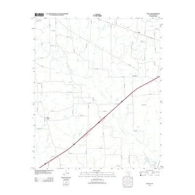
2012 Map of Malta
USGS Topo · Published 2012About this map
Malta and Old Salem sit at the northern reaches of this East Texas landscape, where a dense network of county roads connects rural farmsteads and creek-side settlements. The terrain is defined by a complex web of small waterways including Anderson Cr, Red Bayou, and Austin Chapel Br that drain the timbered and agricultural lands of Bowie County. This 2012 survey illustrates the modern road infrastructure, anchored by the diagonal corridor of the interstate and FM-990 intersecting the countryside near Little Prairie and College Hill. The distribution of these named localities, often centered around historic crossroads or school sites, provides a clear view of the established residential patterns in the region. Local researchers can trace the movement of water through branches like Orear Br and Russet Cr as they feed into larger drainage systems, shaping the land use and property boundaries of the surrounding acreage.
Find a feature on this map
62 named features on this map. Tap any name to fly to it.
Don’t see what you’re looking for? This feature index may not catch every label — zoom into the map to look around manually.
Map Details
Editions of this 2012 Malta Map
This is the sole edition of this map. No revisions or reprints were ever made.
Other maps of this area

1909 · New Boston
USGS Topo · 1:62,500

1930 · Bassett
USGS Topo · 1:62,500

1950 · De Kalb
USGS Topo · 1:24,000

1950 · Oak Grove
USGS Topo · 1:24,000

1951 · De Kalb
USGS Topo · 1:24,000

1951 · Oak Grove
USGS Topo · 1:24,000

1951 · Daniels Chapel
USGS Topo · 1:24,000

1953 · Texarkana
USGS Topo · 1:250,000

1954 · New Boston
USGS Topo · 1:24,000

1955 · Corley
USGS Topo · 1:24,000