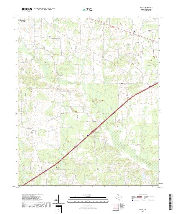
2022 Map of Malta
USGS Topo · Published 2022About this map
Malta and the surrounding Bowie County landscape are defined by a network of creeks and small bayous that drain the terrain toward the Red Bayou. This survey illustrates a rural Texas environment where settlement patterns are anchored by long-standing community landmarks and cemeteries. Historic burial grounds like the Malta Cem, Old Salem Cem, and College Hill Cem serve as critical points of reference for genealogists tracking family roots in the area. The map shows the outskirts of De Kalb and the open spaces of Little Prairie, connected by a grid of county roads and farm-to-market routes. The local hydrology is intricate, with numerous named tributaries such as Anderson Cr, Austin Chapel Br, and Peters Br carving through the countryside. These watercourses and their associated drainage basins have historically influenced both the placement of local roads and the development of agricultural lands in this portion of northeast Texas.
Find a feature on this map
75 named features on this map. Tap any name to fly to it.
Don’t see what you’re looking for? This feature index may not catch every label — zoom into the map to look around manually.
Map Details
Editions of this 2022 Malta Map
This is the sole edition of this map. No revisions or reprints were ever made.
Other maps of this area

1909 · New Boston
USGS Topo · 1:62,500

1930 · Bassett
USGS Topo · 1:62,500

1950 · De Kalb
USGS Topo · 1:24,000

1950 · Oak Grove
USGS Topo · 1:24,000

1951 · De Kalb
USGS Topo · 1:24,000

1951 · Oak Grove
USGS Topo · 1:24,000

1951 · Daniels Chapel
USGS Topo · 1:24,000

1953 · Texarkana
USGS Topo · 1:250,000

1954 · New Boston
USGS Topo · 1:24,000

1955 · Corley
USGS Topo · 1:24,000