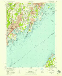
1955 Map of Mamaroneck
USGS Topo · Published 1958About this map
The Mamaroneck coastline and its surrounding Westchester County suburbs show a landscape defined by mid-century affluent development and a deeply indented shoreline. This mid-1950s survey illustrates a period when major transportation arteries like the Hutchinson River Parkway and the New England Thruway were shaping the transit patterns of Rosedale and White Plains. The map captures the distinct character of the Sound Shore communities, where extensive recreational and social grounds like the Westchester Country Club and Apawamis Golf Club occupy significant acreage between residential blocks.
Find a feature on this map
88 named features on this map. Tap any name to fly to it.
Don’t see what you’re looking for? This feature index may not catch every label — zoom into the map to look around manually.
Map Details
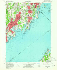
Editions of this 1955 Mamaroneck Map
2 editions found
Other maps of this area

1891 · Harlem
USGS Topo · 1:62,500

1892 · Stamford
USGS Topo · 1:62,500

1892 · Tarrytown
USGS Topo · 1:62,500

1893 · Stamford
USGS Topo · 1:62,500

1893 · Tarrytown
USGS Topo · 1:62,500

1897 · Harlem
USGS Topo · 1:62,500

1897 · Oyster Bay
USGS Topo · 1:62,500

1898 · Harlem
USGS Topo · 1:62,500

1898 · Oyster Bay
USGS Topo · 1:62,500

1899 · Stamford
USGS Topo · 1:62,500