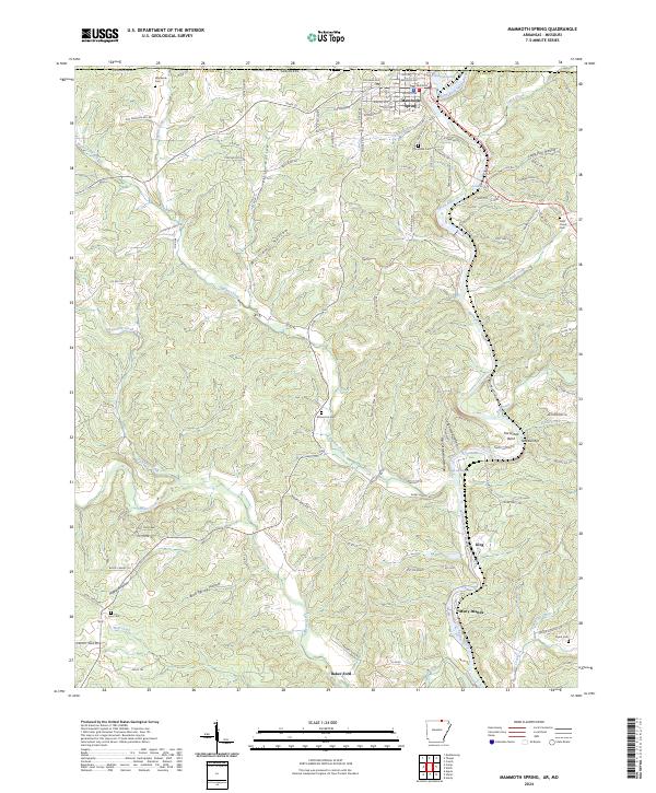
2024 Map of Mammoth Spring
USGS Topo · Published 2024About this map
The Spring River drainage system dominates this northern Arkansas landscape, flowing south from the Missouri border through a complex series of valleys and hollows. The town of Mammoth Spring serves as the regional anchor, situated near the Warm Fork Spring River and the Mammoth Spring National Fish Hatchery. The map reveals a deeply etched topography characterized by numerous namesake hollows like Williams Hollow and Hatfield Hollow, which collect drainage for English Creek and Myatt Creek.
Find a feature on this map
113 named features on this map. Tap any name to fly to it.
Don’t see what you’re looking for? This feature index may not catch every label — zoom into the map to look around manually.
Map Details
Editions of this 2024 Mammoth Spring Map
This is the sole edition of this map. No revisions or reprints were ever made.
Other maps of this area

1943 · Thayer
USGS Topo · 1:62,500

1944 · Couch
USGS Topo · 1:62,500

1946 · Thayer
USGS Topo · 1:62,500

1946 · Couch
USGS Topo · 1:62,500

1957 · Poplar Bluff
USGS Topo · 1:250,000

1959 · Poplar Bluff
USGS Topo · 1:250,000

1960 · Poplar Bluff
USGS Topo · 1:250,000

1962 · Stuart
USGS Topo · 1:24,000

1962 · Agnos
USGS Topo · 1:24,000

1962 · Mammoth Spring
USGS Topo · 1:24,000