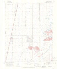
1967 Map of Manassa
USGS Topo · Published 1971About this map
Manassa and its surrounding agricultural valley are defined by a complex network of irrigation works including the Manassa Ditch and Eastfield Ditch, reflecting the communal water management essential to this high desert region in the late 1960s. The landscape is marked by small settlements like Bountiful, Sanford, and Romeo, the latter positioned along the corridor of the Denver and Rio Grande Western Railroad. Local heritage is anchored by sites like Jack Dempsey Park and the Rodeo Ground, while genealogy interest centers on the Old Manassa Cem, Sanford Cem, and Soward Cem. The southeastern terrain transitions into the San Luis Hills, where the Conejos River and Rio San Antonio converge near Dripping Rock, forming a natural boundary to the valley's intensive irrigation system.
Find a feature on this map
41 named features on this map. Tap any name to fly to it.
Don’t see what you’re looking for? This feature index may not catch every label — zoom into the map to look around manually.
Map Details
Editions of this 1967 Manassa Map
3 editions found
Other maps of this area

1922 · Conejos
USGS Topo · 1:125,000

1945 · Durango
USGS Topo · 1:250,000

1953 · Durango
USGS Topo · 1:250,000

1954 · Durango
USGS Topo · 1:250,000

1954 · Trinidad
USGS Topo · 1:250,000

1955 · Trinidad
USGS Topo · 1:250,000

1958 · Trinidad
USGS Topo · 1:250,000

1959 · Trinidad
USGS Topo · 1:250,000

1961 · Durango
USGS Topo · 1:250,000

1963 · Durango
USGS Topo · 1:250,000