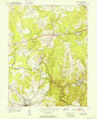
1951 Map of Manassas
USGS Topo · Published 1952About this map
Manassas and Centreville anchor this 1951 survey of the Northern Virginia landscape, showing a transition period as post-war suburban growth began to edge into traditionally rural terrain. The Southern Railway corridor facilitates travel through the southern portion of the map, passing through the historic town of Clifton and near the developing community of Yorkshire Acres. Cultural landmarks like St Timothy's Ch, Mt Olive Ch, and Cub Run Sch reveal the established social centers of the era. The terrain is defined by the winding course of Bull Run, which serves as the boundary between Prince William and Fairfax counties. The map provides specific insights for local historians through small settlement clusters at Johnsons Corner and Uniontown, alongside industrial features like the Quarry near Bull Run.
Find a feature on this map
46 named features on this map. Tap any name to fly to it.
Don’t see what you’re looking for? This feature index may not catch every label — zoom into the map to look around manually.
Map Details
Editions of this 1951 Manassas Map
This is the sole edition of this map. No revisions or reprints were ever made.
Other maps of this area

1890 · Mt. Vernon
USGS Topo · 1:125,000

1891 · Mt. Vernon
USGS Topo · 1:125,000

1894 · Warrenton
USGS Topo · 1:125,000

1894 · Mt. Vernon
USGS Topo · 1:125,000

1897 · Mt. Vernon
USGS Topo · 1:125,000

1915 · Fairfax
USGS Topo · 1:62,500

1927 · Quantico
USGS Topo · 1:62,500

1933 · Middleburg
USGS Topo · 1:62,500

1940 · Quantico
USGS Topo · 1:62,500

1943 · Quantico
USGS Topo · 1:62,500