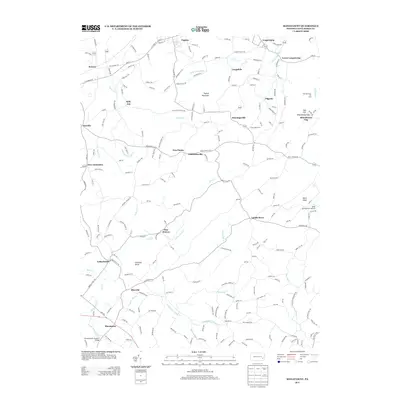
2013 Map of Manatawny
USGS Topo · Published 2013About this map
Bowers and Topton anchor the northern landscape of this Berks County region, where a dense network of local roads connects numerous small settlements. The terrain is defined by distinct landmarks such as Chimney Rocks and Topton Mountain, with the Doe Mountain Ski Area located near the eastern margin. Significant watercourses including Sacony Cr, Pine Cr, and Manatawny Cr drain the area, supporting the historic development of communities like Lobachsville, Pikeville, and Landis Store.
Find a feature on this map
213 named features on this map. Tap any name to fly to it.
Don’t see what you’re looking for? This feature index may not catch every label — zoom into the map to look around manually.
Map Details
Editions of this 2013 Manatawny Map
This is the sole edition of this map. No revisions or reprints were ever made.
Other maps of this area

1894 · Reading
USGS Topo · 1:62,500

1902 · Boyertown
USGS Topo · 1:62,500

1902 · Slatington
USGS Topo · 1:62,500

1909 · Hamburg
USGS Topo · 1:62,500

1911 · Hamburg
USGS Topo · 1:62,500

1913 · Reading
USGS Topo · 1:62,500

1915 · Reading
USGS Topo · 1:62,500
1937 · Allentown West
USGS Topo · 1:48,000
1942 · Allentown West
USGS Topo · 1:62,500
1943 · Manatawny
USGS Topo · 1:31,680