
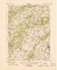
1943 Map of Manatawny
USGS Topo · Published 1943About this map
Topton and Bechtelsville anchor this mid-century survey of the Pennsylvania countryside, where the agricultural landscape of Berks County is defined by its deep-running stream valleys. The Reading railroad corridor passes through the northwestern corner, serving the community of Bowers and the Lutheran Home, while a network of rural roads connects established hamlets like Fredericksville and Landis Store. The terrain is marked by significant rises including Topton Mountain and Gap Hill, which separate the headwaters of the Little Lehigh Creek from the southern drainages.
Find a feature on this map
38 named features on this map. Tap any name to fly to it.
Don’t see what you’re looking for? This feature index may not catch every label — zoom into the map to look around manually.
Map Details
Editions of this 1943 Manatawny Map
This is the sole edition of this map. No revisions or reprints were ever made.
Other maps of this area

1894 · Reading
USGS Topo · 1:62,500

1902 · Boyertown
USGS Topo · 1:62,500

1902 · Slatington
USGS Topo · 1:62,500

1909 · Hamburg
USGS Topo · 1:62,500

1911 · Hamburg
USGS Topo · 1:62,500

1913 · Reading
USGS Topo · 1:62,500

1915 · Reading
USGS Topo · 1:62,500

1937 · Allentown West
USGS Topo · 1:48,000

1942 · Allentown West
USGS Topo · 1:62,500
1943 · East Greenville
USGS Topo · 1:31,680