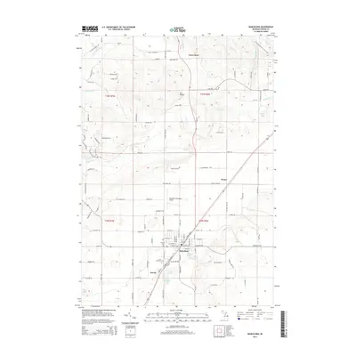
2014 Map of Mancelona
USGS Topo · Published 2014About this map
The community of Mancelona serves as the central hub of this 2014 survey in Antrim County, featuring a distinct grid of streets that transition into the smaller settlement of Antrim to the southwest. This area of northern Michigan is characterized by a landscape of glacial lakes and springs, notably Satterly Lake, Nelson Lake, and Scotts Spring. The terrain rises to Mt Bundy in the north-central section, while the N Country National Scenic Trail cuts through the northeastern corner near the banks of Landslide Cr.
Find a feature on this map
122 named features on this map. Tap any name to fly to it.
Don’t see what you’re looking for? This feature index may not catch every label — zoom into the map to look around manually.
Map Details
Editions of this 2014 Mancelona Map
This is the sole edition of this map. No revisions or reprints were ever made.
Other maps of this area

1954 · Traverse City
USGS Topo · 1:250,000

1955 · Cheboygan
USGS Topo · 1:250,000

1956 · Alba
USGS Topo · 1:62,500

1956 · Mancelona
USGS Topo · 1:62,500

1958 · Cheboygan
USGS Topo · 1:250,000

1958 · Traverse City
USGS Topo · 1:250,000

1961 · Boyne Falls
USGS Topo · 1:62,500

1961 · Boyne City
USGS Topo · 1:62,500

1975 · Mancelona NE
USGS Topo · 1:24,000

1975 · Mancelona NW
USGS Topo · 1:24,000