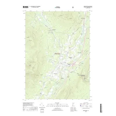
2018 Map of Manchester
USGS Topo · Published 2018About this map
The Green Mountain National Forest dominates this landscape, framing the valley where settlements like Manchester and East Dorset thrive. The region is defined by its deep verticality, with heights such as Owls Head and Mt Aeolus overlooking narrow hollows like Skinner Hollow and Corbett Hollow. This elevation creates a complex drainage system where the Batten Kill and W Br Batten Kill collect mountain runoff from dozens of smaller tributaries, including Bromley Brook and Munson Brook.
Find a feature on this map
98 named features on this map. Tap any name to fly to it.
Don’t see what you’re looking for? This feature index may not catch every label — zoom into the map to look around manually.
Map Details
Editions of this 2018 Manchester Map
This is the sole edition of this map. No revisions or reprints were ever made.
Other maps of this area

1893 · Wallingford
USGS Topo · 1:62,500

1894 · Londonderry
USGS Topo · 1:62,500

1894 · Pawlet
USGS Topo · 1:62,500

1894 · Equinox
USGS Topo · 1:62,500

1896 · Equinox
USGS Topo · 1:62,500

1897 · Pawlet
USGS Topo · 1:62,500

1899 · Londonderry
USGS Topo · 1:62,500

1900 · Equinox
USGS Topo · 1:62,500

1903 · Mettawee
USGS Topo · 1:125,000

1950 · Glens Falls
USGS Topo · 1:250,000