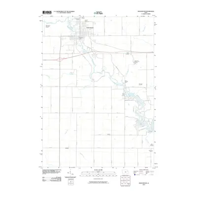
2010 Map of Manchester
USGS Topo · Published 2010About this map
The Maquoketa River serves as the central artery for this region, winding past the county seat of Manchester and continuing south toward the waters of Hartwick Lake. This 2010 survey highlights a landscape where traditional agricultural patterns meet specialized modern infrastructure, notably the Manchester National Fish Hatchery and the Manchester Municipal Airport. Genealogists will find a high density of burial sites throughout the township, ranging from the large Oakland Cemetery and Saint Marys Cemetery in the north to the Sands Farm Cemetery and Milo Township Cemetery in the southeast corner. The presence of the Bailey's Ford Post Office and Baileys Ford Cemetery near a prominent bend in the river suggests a historic crossing point that has remained a local landmark. Further south, the small settlement of Golden sits at the junction of Todds Creek and the Golden Branch, illustrating the enduring importance of these minor waterways to local geography.
Find a feature on this map
40 named features on this map. Tap any name to fly to it.
Don’t see what you’re looking for? This feature index may not catch every label — zoom into the map to look around manually.
Map Details
Editions of this 2010 Manchester Map
This is the sole edition of this map. No revisions or reprints were ever made.
Other maps of this area

1900 · Anamosa
USGS Topo · 1:125,000

1901 · Oelwein
USGS Topo · 1:125,000

1902 · Elkader
USGS Topo · 1:125,000

1903 · Winthrop
USGS Topo · 1:125,000

1959 · Dubuque
USGS Topo · 1:250,000

1961 · Dubuque
USGS Topo · 1:250,000

1962 · Dubuque
USGS Topo · 1:250,000

1965 · Thorpe
USGS Topo · 1:24,000
1965 · Greeley
USGS Topo · 1:24,000

1965 · Dundee
USGS Topo · 1:24,000