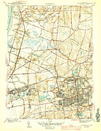
1944 Map of Manchester
USGS Topo · Published 1944About this map
The industrial and agricultural corridors of central Connecticut are documented here just before the mid-century suburban expansion. The New York New Haven and Hartford RR forms a vital transportation spine through Manchester and South Manchester, connecting manufacturing hubs to the broader region. Water power remains central to the landscape, with the Hockanum River and Podunk River feeding numerous industrial impoundments like Union Pond and Hillard Pond.
Find a feature on this map
108 named features on this map. Tap any name to fly to it.
Don’t see what you’re looking for? This feature index may not catch every label — zoom into the map to look around manually.
Map Details
Editions of this 1944 Manchester Map
3 editions found

Other maps of this area

1892 · Hartford
USGS Topo · 1:62,500

1892 · Tolland
USGS Topo · 1:62,500

1892 · Gilead
USGS Topo · 1:62,500

1893 · Middletown
USGS Topo · 1:62,500

1906 · Farmington
USGS Topo · 1:125,000

1921 · Tolland
USGS Topo · 1:62,500

1928 · Windsor Locks
USGS Topo · 1:24,000

1928 · Windsor
USGS Topo · 1:24,000

1928 · Glastonbury
USGS Topo · 1:24,000

1928 · Broad Brook
USGS Topo · 1:24,000