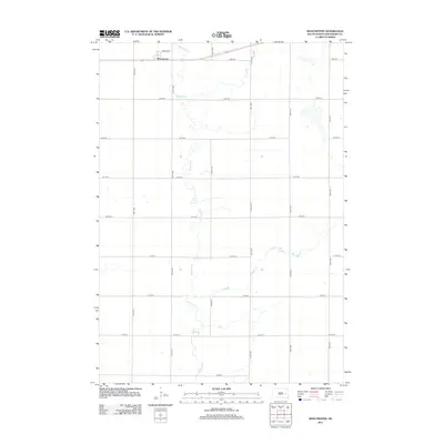
2012 Map of Manchester
USGS Topo · Published 2012About this map
Manchester sits at the northern edge of this Kingsbury County quadrangle, a small hub defined by the intersection of Highway 14 and a grid of rural section roads. The landscape is characterized by the meandering path of Redstone Cr, which snakes vertically through the center of the survey area, cutting across the steady geometry of the South Dakota prairie. Aside from the primary settlement and the thoroughfare of Stephen St, the map reflects a high-plains agricultural environment where the built environment is almost entirely structured around north-south avenues like 425th Ave and east-west streets ranging from 208th St down to 216th St. This 2012 survey captures the spatial relationship between the town and the local drainage systems that shape the surrounding farmland.
Find a feature on this map
19 named features on this map. Tap any name to fly to it.
Don’t see what you’re looking for? This feature index may not catch every label — zoom into the map to look around manually.
Map Details
Editions of this 2012 Manchester Map
This is the sole edition of this map. No revisions or reprints were ever made.
Other maps of this area

1899 · De Smet
USGS Topo · 1:125,000

1953 · Watertown
USGS Topo · 1:250,000

1958 · Watertown
USGS Topo · 1:250,000

1971 · Iroquois
USGS Topo · 1:24,000

1971 · Howard NE
USGS Topo · 1:24,000

1971 · Bancroft East
USGS Topo · 1:24,000

1971 · De Smet
USGS Topo · 1:24,000

1971 · Bancroft West
USGS Topo · 1:24,000

1971 · De Smet SE
USGS Topo · 1:24,000

1971 · Artesian NE
USGS Topo · 1:24,000