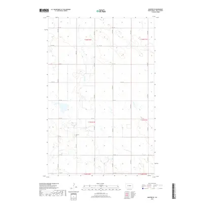
2018 Map of Manfred SE
USGS Topo · Published 2018About this map
The James River meanders through this portion of Wells County, shaping a rural landscape defined by the North Dakota prairie's characteristic section-line road system. This modern survey illustrates the enduring agricultural layout of the region, where a grid of numbered thoroughfares such as 14th St NE and 34th Ave NE provides the primary infrastructure for local farms. A significant landmark for genealogists and local historians is the Mennonite Cem, located near the riverbank in township T147N R72W. The map documents the extensive network of wetlands and small prairie potholes that dot the terrain between the river valley and the surrounding uplands, reflecting the natural hydrology of the Great Plains in the early 21st century.
Find a feature on this map
23 named features on this map. Tap any name to fly to it.
Don’t see what you’re looking for? This feature index may not catch every label — zoom into the map to look around manually.
Map Details
Editions of this 2018 Manfred SE Map
This is the sole edition of this map. No revisions or reprints were ever made.
Other maps of this area

1945 · Manfred
USGS Topo · 1:62,500

1948 · Fessenden
USGS Topo · 1:62,500

1948 · Manfred
USGS Topo · 1:62,500

1949 · Fessenden SW
USGS Topo · 1:24,000

1949 · Fessenden West
USGS Topo · 1:24,000

1949 · Manfred SW
USGS Topo · 1:24,000

1950 · Manfred SE
USGS Topo · 1:24,000

1950 · Manfred NW
USGS Topo · 1:24,000

1950 · Manfred
USGS Topo · 1:24,000

1950 · Manfred SW
USGS Topo · 1:24,000