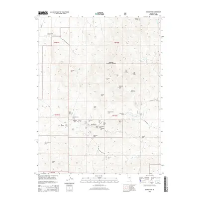
2014 Map of Manhattan
USGS Topo · Published 2014About this map
Manhattan sits at the heart of this high-altitude landscape, surrounded by a dense concentration of named hills and gulches that speak to a deep mining heritage. Located within the Toiyabe National Forest, the settlement is flanked by the Toquima Range and peaks such as Salisbury Peak and Clover Mtn. The map reveals a complex geography of resource extraction and local nomenclature, with features like Gold Hill, April Fool Hill, and Toro Blanco Hill crowded around the town site.
Find a feature on this map
53 named features on this map. Tap any name to fly to it.
Don’t see what you’re looking for? This feature index may not catch every label — zoom into the map to look around manually.
Map Details
Editions of this 2014 Manhattan Map
This is the sole edition of this map. No revisions or reprints were ever made.
Other maps of this area

1907 · Tonopah
USGS Topo · 1:250,000

1908 · Tonopah
USGS Topo · 1:250,000

1956 · Tonopah
USGS Topo · 1:250,000

1959 · Tonopah
USGS Topo · 1:250,000

1962 · Tonopah
USGS Topo · 1:250,000

1963 · Baxter Spring
USGS Topo · 1:62,500

1971 · Seyler Peak
USGS Topo · 1:24,000

1971 · Manhattan
USGS Topo · 1:24,000

1971 · Pablo Canyon Ranch
USGS Topo · 1:24,000

1971 · Belmont West
USGS Topo · 1:24,000