
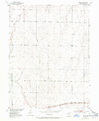
1951 Map of Manila
USGS Topo · Published 1953About this map
Union Pacific tracks run across the southern edge of this high plains landscape, anchoring the small settlement of Manila. The 1950s terrain is defined by dry drainage systems, most notably Box Elder Creek and Horse Creek, which cut through the undulating surface of Adams County. Local irrigation history is visible in the network of dry infrastructure, including the Lone Tree Ditch (Abandoned) and other unnamed abandoned ditches, suggesting a period of shifting water management and agricultural change in the mid-20th century.
Find a feature on this map
9 named features on this map. Tap any name to fly to it.
Don’t see what you’re looking for? This feature index may not catch every label — zoom into the map to look around manually.
Map Details
Editions of this 1951 Manila Map
2 editions found
Other maps of this area

1890 · East Denver
USGS Topo · 1:125,000

1939 · Coal Creek
USGS Topo · 1:24,000

1942 · Mile High Lakes
USGS Topo · 1:31,680

1942 · Box Elder School
USGS Topo · 1:31,680

1942 · Coal Creek
USGS Topo · 1:31,680

1949 · Sunnydale
USGS Topo · 1:24,000

1949 · Bennett
USGS Topo · 1:24,000
1952 · Horse Creek
USGS Topo · 1:24,000

1953 · Denver
USGS Topo · 1:250,000

1954 · Watkins
USGS Topo · 1:24,000