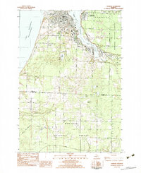
1982 Map of Manistee
USGS Topo · Published 1983About this map
Manistee and its industrial waterfront on Manistee Lake dominate this 1980s landscape, illustrating the complex relationship between the city's urban grid and its natural harbor. The residential expansion is evident in neighborhoods like Oak Hill and East Lake, while the presence of the Chesapeake and Ohio railroad along the eastern shore highlights the ongoing importance of the timber and salt shipping routes. This survey captures a moment of transition where established educational institutions like Central High Sch and Trinity Sch are surrounded by extensive public works, including several waste treatment plants near the Manistee River.
Find a feature on this map
50 named features on this map. Tap any name to fly to it.
Don’t see what you’re looking for? This feature index may not catch every label — zoom into the map to look around manually.
Map Details
Editions of this 1982 Manistee Map
3 editions found
Other maps of this area

1931 · Manistee SE
USGS Topo · 1:31,680

1931 · Freesoil SW
USGS Topo · 1:31,680

1931 · Manistee SW
USGS Topo · 1:31,680

1954 · Manitowoc
USGS Topo · 1:250,000

1956 · Onekama
USGS Topo · 1:62,500

1956 · Bar Lake
USGS Topo · 1:62,500

1957 · Freesoil
USGS Topo · 1:62,500

1958 · Manitowoc
USGS Topo · 1:250,000

1958 · Manistee
USGS Topo · 1:62,500

1976 · Onekama SW
USGS Topo · 1:24,000