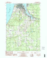
1982 Map of Manistee
USGS Topo · Published 1991About this map
The industrial and maritime hub of Manistee dominates the northern shoreline of Manistee Lake, where the Manistee River flows into Lake Michigan. This 1982 survey illustrates a complex landscape of coastal industry and residential expansion, featuring the Chesapeake and Ohio RR and the Manistee and Northeastern RR serving the lakefront. Communities like East Lake, Filer City, and Stronach ring the water, supporting the local economy alongside facilities such as the Sewage Treatment Plant and Water Plant.
Find a feature on this map
48 named features on this map. Tap any name to fly to it.
Don’t see what you’re looking for? This feature index may not catch every label — zoom into the map to look around manually.
Map Details
Editions of this 1982 Manistee Map
3 editions found
Other maps of this area

1931 · Manistee SE
USGS Topo · 1:31,680

1931 · Freesoil SW
USGS Topo · 1:31,680

1931 · Manistee SW
USGS Topo · 1:31,680

1954 · Manitowoc
USGS Topo · 1:250,000

1956 · Onekama
USGS Topo · 1:62,500

1956 · Bar Lake
USGS Topo · 1:62,500

1957 · Freesoil
USGS Topo · 1:62,500

1958 · Manitowoc
USGS Topo · 1:250,000

1958 · Manistee
USGS Topo · 1:62,500

1976 · Onekama SW
USGS Topo · 1:24,000