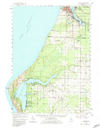
1958 Map of Manistee
USGS Topo · Published 1983About this map
Industrial salt production and lakeborne commerce define this mid-century survey of the Lake Michigan coast. The city of Manistee and neighboring Filer City sit at the mouth of the Manistee River, where numerous salt wells and gravel pits indicate the region's active extraction economy. Further inland, the map captures a rural landscape of one-room schoolhouses and country parishes, such as the Flynn Sch and Trinity Ch, serving the farming communities of Mason and Manistee Counties.
Find a feature on this map
67 named features on this map. Tap any name to fly to it.
Don’t see what you’re looking for? This feature index may not catch every label — zoom into the map to look around manually.
Map Details
Editions of this 1958 Manistee Map
3 editions found

Other maps of this area

1931 · Custer NW
USGS Topo · 1:31,680

1931 · Manistee SE
USGS Topo · 1:31,680

1931 · Freesoil SW
USGS Topo · 1:31,680

1931 · Manistee SW
USGS Topo · 1:31,680

1932 · Ludington NE
USGS Topo · 1:31,680

1932 · Ludington
USGS Topo · 1:31,680

1954 · Milwaukee
USGS Topo · 1:250,000

1954 · Manitowoc
USGS Topo · 1:250,000

1956 · Onekama
USGS Topo · 1:62,500

1956 · Bar Lake
USGS Topo · 1:62,500