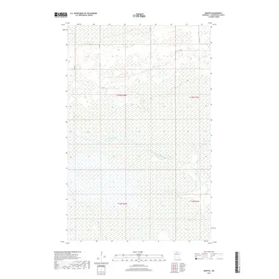
2019 Map of Manitou
USGS Topo · Published 2019About this map
The W Fork Black River snakes across this corner of Koochiching County, defining the drainage of a landscape dominated by extensive wetlands. This 2019 survey documents a sparsely settled region of the North Woods where the Public Land Survey System grids meet the natural wandering of the river fork. Transportation is confined to a skeletal network of county roads and utility trails, such as Co Rd 84 and Ut 120, which provide the primary access through the surrounding marshes and low-lying woods. The map highlights the intersection of several townships, including t159n r26w and t159n r25w, revealing the persistent rural character of this northern Minnesota borderland.
Find a feature on this map
12 named features on this map. Tap any name to fly to it.
Don’t see what you’re looking for? This feature index may not catch every label — zoom into the map to look around manually.
Map Details
Editions of this 2019 Manitou Map
This is the sole edition of this map. No revisions or reprints were ever made.
Other maps of this area

1919 · Birchdale
USGS Topo · 1:62,500

1919 · I
USGS Topo · 1:62,500

1943 · Lindford
USGS Topo · 1:62,500

1954 · Roseau
USGS Topo · 1:250,000

1954 · International Falls
USGS Topo · 1:250,000

1957 · Roseau
USGS Topo · 1:250,000

1957 · International Falls
USGS Topo · 1:250,000

1958 · International Falls
USGS Topo · 1:250,000

1958 · Roseau
USGS Topo · 1:250,000

1968 · Birchdale SE
USGS Topo · 1:24,000