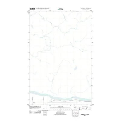
2011 Map of Manitou OE N
USGS Topo · Published 2011About this map
Manitou sits along the northern banks of the Rainy River, which serves as a prominent international boundary between Minnesota and Ontario. This 2011 survey illustrates the rural landscape along the river corridor, where the waterway remains the primary geographical focal point. The terrain is characterized by modest drainage features such as Burton Creek, which flows south to meet the larger river. Local transportation infrastructure is defined by a simple network of rural routes, including County Hwy 148 and Town Road 121, which provide access to the riverfront properties and agricultural lands north of the border. The map reflects a quiet, sparsely populated borderland area defined by its river-oriented geography and cross-border proximity.
Find a feature on this map
5 named features on this map. Tap any name to fly to it.
Don’t see what you’re looking for? This feature index may not catch every label — zoom into the map to look around manually.
Map Details
Editions of this 2011 Manitou OE N Map
This is the sole edition of this map. No revisions or reprints were ever made.
Other maps of this area

1919 · Birchdale
USGS Topo · 1:62,500

1954 · Roseau
USGS Topo · 1:250,000

1954 · International Falls
USGS Topo · 1:250,000

1957 · Roseau
USGS Topo · 1:250,000

1957 · International Falls
USGS Topo · 1:250,000

1958 · International Falls
USGS Topo · 1:250,000

1958 · Roseau
USGS Topo · 1:250,000

1968 · Birchdale SE
USGS Topo · 1:24,000
1968 · Birchdale
USGS Topo · 1:24,000
1970 · Manitou
USGS Topo · 1:24,000