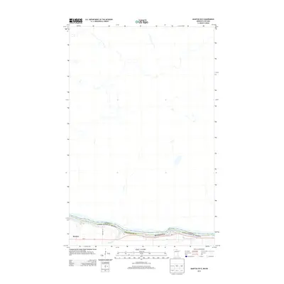
2013 Map of Manitou OE N
USGS Topo · Published 2013About this map
Rainy River serves as the international boundary on this 2013 survey, dividing the United States and Canada. In Koochiching Co, the settlement of Manitou is situated along the southern bank, where the landscape is defined by the winding course of the river and the input of Burton Cr. This northern Minnesota borderland displays a characteristic transition from river-bottom geography to the expansive, less-developed reaches to the north. Transportation in the area is facilitated by MN-11, which parallels the waterway, and secondary routes like Town Road 121 that lead into the interior. The map illustrates the proximity of these small border communities to the Canadian frontier, capturing the isolated but interconnected nature of the region's river-based settlement pattern.
Find a feature on this map
8 named features on this map. Tap any name to fly to it.
Don’t see what you’re looking for? This feature index may not catch every label — zoom into the map to look around manually.
Map Details
Editions of this 2013 Manitou OE N Map
This is the sole edition of this map. No revisions or reprints were ever made.
Other maps of this area

1919 · Birchdale
USGS Topo · 1:62,500

1954 · Roseau
USGS Topo · 1:250,000

1954 · International Falls
USGS Topo · 1:250,000

1957 · Roseau
USGS Topo · 1:250,000

1957 · International Falls
USGS Topo · 1:250,000

1958 · International Falls
USGS Topo · 1:250,000

1958 · Roseau
USGS Topo · 1:250,000

1968 · Birchdale SE
USGS Topo · 1:24,000
1968 · Birchdale
USGS Topo · 1:24,000
1970 · Manitou
USGS Topo · 1:24,000