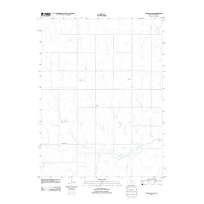
2012 Map of Mankato NW
USGS Topo · Published 2012About this map
Shaffer Cem, Cleveland Cem, and Olive Hill Cem dot the uplands of Jewell County, marking the long-established burial grounds of this rural Kansas landscape. The area is defined by a dense network of south-flowing drainages including Oak Cr, Norway Cr, and Taylor Cr, all of which eventually feed into the meandering course of White Rock Cr in the southern portion of the quadrangle. This 2012 survey reveals a classic Midwestern section-line road grid, where travel is dictated by cardinal directions and primary routes like White Rock Rd. The land remains primarily agricultural, with small farmstead structures and isolated groves scattered between the creek beds. Further south, the terrain becomes more varied as Big Timber Cr and Troublesome Cr approach the main river valley, showing the intricate hydrology that has shaped farming and settlement patterns here for generations.
Find a feature on this map
15 named features on this map. Tap any name to fly to it.
Don’t see what you’re looking for? This feature index may not catch every label — zoom into the map to look around manually.
Map Details
Editions of this 2012 Mankato NW Map
This is the sole edition of this map. No revisions or reprints were ever made.
Other maps of this area

1894 · Mankato
USGS Topo · 1:125,000

1898 · Superior
USGS Topo · 1:125,000

1955 · Grand Island
USGS Topo · 1:250,000

1955 · Beloit
USGS Topo · 1:250,000

1957 · Grand Island
USGS Topo · 1:250,000

1958 · Grand Island
USGS Topo · 1:250,000

1959 · Beloit
USGS Topo · 1:250,000

1968 · Burr Oak
USGS Topo · 1:24,000

1969 · Mankato
USGS Topo · 1:24,000
1969 · Montrose
USGS Topo · 1:24,000