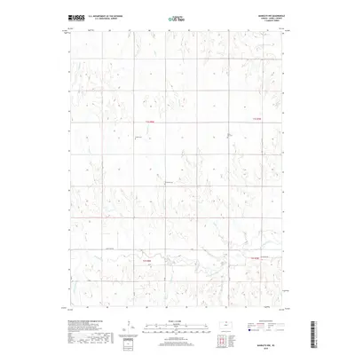
2018 Map of Mankato NW
USGS Topo · Published 2018About this map
White Rock Creek meanders through the southern portion of this Jewell County landscape, serving as a primary drainage for a network of prairie tributaries. The area is defined by a traditional sectional grid of rural roads, including White Rock Rd and X Rd, which navigate a terrain carved by numerous seasonal streams like Taylor Cr and Norway Cr. This 2018 survey reveals the persistent presence of small rural burial grounds, including Shaffer Cem, Olive Hill Cem, and Cleveland Cem, which remain as fixed markers of the early families who settled these uplands. The absence of significant townsites emphasizes the agricultural character of the region, where the land is primarily divided by watercourses such as Korb Cr and Gimlet Cr, and a precise network of range and township lines.
Find a feature on this map
27 named features on this map. Tap any name to fly to it.
Don’t see what you’re looking for? This feature index may not catch every label — zoom into the map to look around manually.
Map Details
Editions of this 2018 Mankato NW Map
This is the sole edition of this map. No revisions or reprints were ever made.
Other maps of this area

1894 · Mankato
USGS Topo · 1:125,000

1898 · Superior
USGS Topo · 1:125,000

1955 · Grand Island
USGS Topo · 1:250,000

1955 · Beloit
USGS Topo · 1:250,000

1957 · Grand Island
USGS Topo · 1:250,000

1958 · Grand Island
USGS Topo · 1:250,000

1959 · Beloit
USGS Topo · 1:250,000

1968 · Burr Oak
USGS Topo · 1:24,000

1969 · Mankato
USGS Topo · 1:24,000
1969 · Montrose
USGS Topo · 1:24,000