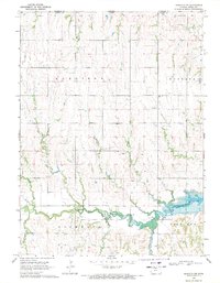
1969 Map of Mankato NW
USGS Topo · Published 1971About this map
The Lovewell Reservoir anchors the southeastern landscape of this Jewell County region, where the White Rock Creek valley meets the Nebraska-Kansas state line. The survey captures a rural landscape defined by township boundaries including Harrison, Montana, Holmwood, and Richland. Settlement patterns are traced through communal landmarks like the Olive Hill Ch and several burial grounds including Cleveland Cem and Shaffer Cem. A dense network of drainage, including Norwegian Creek, Taylor Creek, and Spring Creek, dissects the terrain, while numerous small Quarries and gravel pits suggest the local extractive activity that supported area infrastructure during the late 1960s. The presence of Troublesome Creek and Big Timber Creek further illustrates the complex watershed feeding into the reservoir system.
Find a feature on this map
23 named features on this map. Tap any name to fly to it.
Don’t see what you’re looking for? This feature index may not catch every label — zoom into the map to look around manually.
Map Details
Editions of this 1969 Mankato NW Map
This is the sole edition of this map. No revisions or reprints were ever made.
Other maps of this area

1894 · Mankato
USGS Topo · 1:125,000

1898 · Superior
USGS Topo · 1:125,000

1955 · Grand Island
USGS Topo · 1:250,000

1955 · Beloit
USGS Topo · 1:250,000

1957 · Grand Island
USGS Topo · 1:250,000

1958 · Grand Island
USGS Topo · 1:250,000

1959 · Beloit
USGS Topo · 1:250,000

1968 · Burr Oak
USGS Topo · 1:24,000

1969 · Mankato
USGS Topo · 1:24,000
1969 · Montrose
USGS Topo · 1:24,000