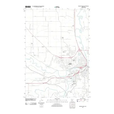
2010 Map of Mankato West
USGS Topo · Published 2010About this map
The Minnesota River and the Blue Earth River define the development of this riverbend landscape, where the urban expansion of North Mankato meets the rural agricultural sections of Belgrade Township. This 2010 survey documents a high concentration of memorial sites and family history markers, including Kern's Cemetery, Belgrade Swedish Cemetery, and Sibley Mound Cemetery. These landmarks, along with smaller settlements like Kerns and Le Hillier, provide essential data for genealogists tracking local ancestry in Blue Earth County.
Find a feature on this map
62 named features on this map. Tap any name to fly to it.
Don’t see what you’re looking for? This feature index may not catch every label — zoom into the map to look around manually.
Map Details
Editions of this 2010 Mankato West Map
This is the sole edition of this map. No revisions or reprints were ever made.
Other maps of this area

1950 · Mankato East
USGS Topo · 1:62,500

1951 · Mankato East
USGS Topo · 1:62,500

1951 · Mankato West
USGS Topo · 1:62,500

1953 · Saint Paul
USGS Topo · 1:250,000

1953 · New Ulm
USGS Topo · 1:250,000

1957 · New Ulm
USGS Topo · 1:250,000

1958 · New Ulm
USGS Topo · 1:250,000

1959 · Saint Paul
USGS Topo · 1:250,000

1965 · North Star
USGS Topo · 1:24,000
1965 · St Peter
USGS Topo · 1:24,000