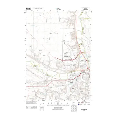
2013 Map of Mankato West
USGS Topo · Published 2013About this map
The Minnesota River serves as the central geographic spine for this area, carving a wide valley where the cities of Mankato and North Mankato meet. These urban centers are joined by the Blue Earth River, which enters from the south, passing the Mount Kato Ski Area and the Le Hillier settlement. The terrain here is marked by significant elevation changes, particularly along the river bluffs where local landmarks like Minnewankon Falls and Minnemishinona Falls emphasize the region's unique drainage patterns.
Find a feature on this map
82 named features on this map. Tap any name to fly to it.
Don’t see what you’re looking for? This feature index may not catch every label — zoom into the map to look around manually.
Map Details
Editions of this 2013 Mankato West Map
This is the sole edition of this map. No revisions or reprints were ever made.
Other maps of this area

1950 · Mankato East
USGS Topo · 1:62,500

1951 · Mankato East
USGS Topo · 1:62,500

1951 · Mankato West
USGS Topo · 1:62,500

1953 · Saint Paul
USGS Topo · 1:250,000

1953 · New Ulm
USGS Topo · 1:250,000

1957 · New Ulm
USGS Topo · 1:250,000

1958 · New Ulm
USGS Topo · 1:250,000

1959 · Saint Paul
USGS Topo · 1:250,000

1965 · North Star
USGS Topo · 1:24,000
1965 · St Peter
USGS Topo · 1:24,000