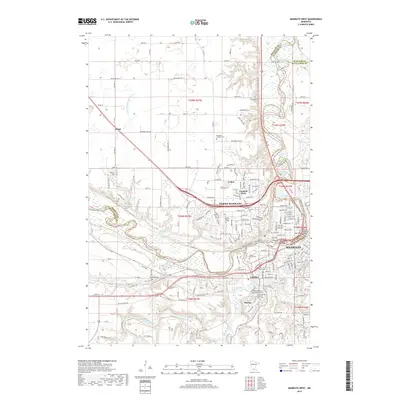
2019 Map of Mankato West
USGS Topo · Published 2019About this map
The Minnesota River carves a sharp, serpentine path through this landscape, serving as the primary geographic divider between North Mankato and the western edge of Mankato. The convergence of the Blue Earth River and Minneopa Creek with the larger river creates a complex hydrology that has historically shaped the development of riverside communities like LeHillier and the elevated city of Skyline. Local history is anchored by a significant number of burial grounds, including the Belgrade Cem, Kerns Cem, and the notable Sibley Mound Cem.
Find a feature on this map
123 named features on this map. Tap any name to fly to it.
Don’t see what you’re looking for? This feature index may not catch every label — zoom into the map to look around manually.
Map Details
Editions of this 2019 Mankato West Map
This is the sole edition of this map. No revisions or reprints were ever made.
Other maps of this area

1950 · Mankato East
USGS Topo · 1:62,500

1951 · Mankato East
USGS Topo · 1:62,500

1951 · Mankato West
USGS Topo · 1:62,500

1953 · Saint Paul
USGS Topo · 1:250,000

1953 · New Ulm
USGS Topo · 1:250,000

1957 · New Ulm
USGS Topo · 1:250,000

1958 · New Ulm
USGS Topo · 1:250,000

1959 · Saint Paul
USGS Topo · 1:250,000

1965 · North Star
USGS Topo · 1:24,000
1965 · St Peter
USGS Topo · 1:24,000