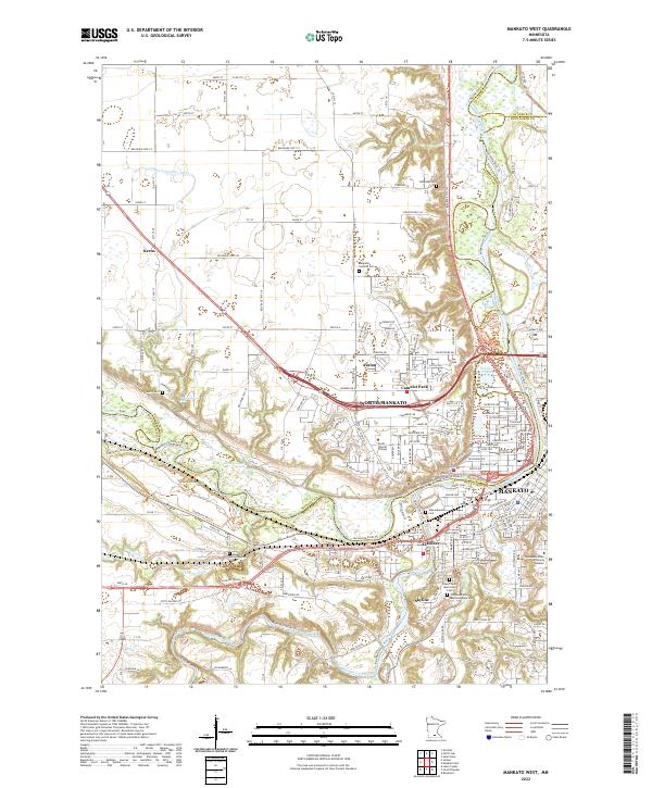
2022 Map of Mankato West
USGS Topo · Published 2022About this map
The confluence of the Minnesota River and Blue Earth River dominates this detailed survey of the Mankato area, where the valley terrain dictates the layout of modern infrastructure. Residential expansion is visible across North Mankato and Mankato, while smaller settlements like Le Hillier, Skyline, and Kerns occupy the surrounding bluffs and lowlands. A significant focus on the southwestern portion of the sheet reveals the grounds of Minneopa Falls and its associated landmarks, including Minneopa Cem and the Bison Enclosure Trail.
Find a feature on this map
82 named features on this map. Tap any name to fly to it.
Don’t see what you’re looking for? This feature index may not catch every label — zoom into the map to look around manually.
Map Details
Editions of this 2022 Mankato West Map
This is the sole edition of this map. No revisions or reprints were ever made.
Other maps of this area

1950 · Mankato East
USGS Topo · 1:62,500

1951 · Mankato East
USGS Topo · 1:62,500

1951 · Mankato West
USGS Topo · 1:62,500

1953 · Saint Paul
USGS Topo · 1:250,000

1953 · New Ulm
USGS Topo · 1:250,000

1957 · New Ulm
USGS Topo · 1:250,000

1958 · New Ulm
USGS Topo · 1:250,000

1959 · Saint Paul
USGS Topo · 1:250,000

1965 · North Star
USGS Topo · 1:24,000
1965 · St Peter
USGS Topo · 1:24,000