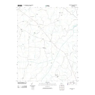
2010 Map of Manleyville
USGS Topo · Published 2010About this map
Manleyville Cemetery and numerous family burying grounds are scattered across this rural Henry County landscape, indicating a long-established network of small agricultural communities. The Big Sandy River meanders through the eastern half of the quadrangle, joined by a dense web of tributaries including Bear Creek, Gin Creek, and Raccoon Branch. These waterways, along with features like Crossnoe Slough, dictate the layout of local roads and the placement of settlements like Pleasant Hill and Halls.
Find a feature on this map
69 named features on this map. Tap any name to fly to it.
Don’t see what you’re looking for? This feature index may not catch every label — zoom into the map to look around manually.
Map Details
Editions of this 2010 Manleyville Map
This is the sole edition of this map. No revisions or reprints were ever made.
Other maps of this area

1936 · Poplar Creek
USGS Topo · 1:24,000

1936 · Camden
USGS Topo · 1:24,000

1936 · Big Sandy
USGS Topo · 1:24,000

1936 · Mansfield
USGS Topo · 1:24,000

1936 · Vale
USGS Topo · 1:24,000

1936 · Bruceton
USGS Topo · 1:24,000

1936 · Manleyville
USGS Topo · 1:24,000

1936 · Paris
USGS Topo · 1:24,000

1936 · Springville
USGS Topo · 1:24,000

1938 · Springville
USGS Topo · 1:24,000