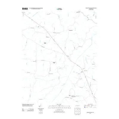
2013 Map of Manleyville
USGS Topo · Published 2013About this map
The Big Sandy River defines the southeastern landscape of this Henry County region, where the river's slow-moving waters and adjacent Crossnoe Slough create a network of wetlands and seasonal drainages. Modern aviation interests are evident at the Paris Landing Airpark and Meadowlark Airport, while the underlying settlement pattern remains tied to historic crossroads like Manleyville and Springville. This 2013 survey illustrates a landscape heavily modified by water management projects, most notably the West Sandy Creek Drainage Ditch and the Rushing Creek Drainage Ditch, which redirect flow across the low-lying terrain. Rural life is anchored by small communities such as Bain, Halls, and Pleasant Hill, connected by long-established thoroughfares like Reynoldsburg Rd.
Find a feature on this map
71 named features on this map. Tap any name to fly to it.
Don’t see what you’re looking for? This feature index may not catch every label — zoom into the map to look around manually.
Map Details
Editions of this 2013 Manleyville Map
This is the sole edition of this map. No revisions or reprints were ever made.
Other maps of this area

1936 · Poplar Creek
USGS Topo · 1:24,000

1936 · Camden
USGS Topo · 1:24,000

1936 · Big Sandy
USGS Topo · 1:24,000

1936 · Mansfield
USGS Topo · 1:24,000

1936 · Vale
USGS Topo · 1:24,000

1936 · Bruceton
USGS Topo · 1:24,000

1936 · Manleyville
USGS Topo · 1:24,000

1936 · Paris
USGS Topo · 1:24,000

1936 · Springville
USGS Topo · 1:24,000

1938 · Springville
USGS Topo · 1:24,000