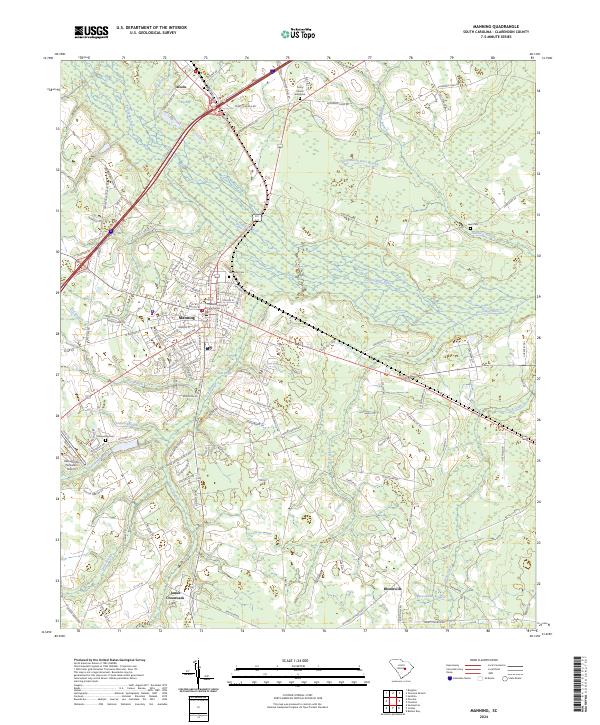
2024 Map of Manning
USGS Topo · Published 2024About this map
The Clarendon County Courthouse serves as the central landmark for the town of Manning, situated within a landscape defined by the intricate hydrology of the Pocotaligo River basin. This modern 2024 survey reveals a transition from the urban grid of the county seat to the sprawling wetlands and bay features typical of the South Carolina coastal plain, such as Big Bay and Gum Pond. The settlement pattern follows historical corridors, with Alcolu to the north and the rural community of Bloomville to the south.
Find a feature on this map
126 named features on this map. Tap any name to fly to it.
Don’t see what you’re looking for? This feature index may not catch every label — zoom into the map to look around manually.
Map Details
Editions of this 2024 Manning Map
This is the sole edition of this map. No revisions or reprints were ever made.
Historical Maps of Manning Through Time
5 maps found