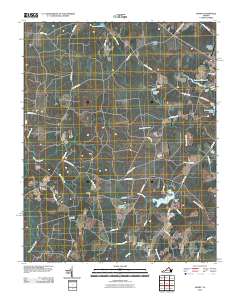
2010 Map of Manry
USGS Topo · Published 2010About this map
Manry and its surrounding rural hamlets are defined by a network of expansive wetlands and managed waterways in this coastal plain landscape. Low-lying tracts like Seacock Swamp and Assamoosick Swamp are interspersed with man-made features that trace the area's agricultural and industrial history, such as Brittles Millpond and Laniers Millpond. The infrastructure of the early 21st century is evident in the presence of the Wakefield Municipal Airport at the northeastern corner, contrasting with the legacy of localized family and community landmarks.
Find a feature on this map
58 named features on this map. Tap any name to fly to it.
Don’t see what you’re looking for? This feature index may not catch every label — zoom into the map to look around manually.
Map Details
Editions of this 2010 Manry Map
This is the sole edition of this map. No revisions or reprints were ever made.
Other maps of this area

1919 · Surry
USGS Topo · 1:62,500

1919 · Disputanta
USGS Topo · 1:62,500

1919 · Homeville
USGS Topo · 1:48,000

1920 · Ivor
USGS Topo · 1:62,500

1920 · Homeville
USGS Topo · 1:62,500

1943 · Sebrell
USGS Topo · 1:31,680

1943 · Manry
USGS Topo · 1:31,680

1943 · Littleton
USGS Topo · 1:31,680

1943 · Vicksville
USGS Topo · 1:31,680

1943 · Richmond
USGS Topo · 1:250,000