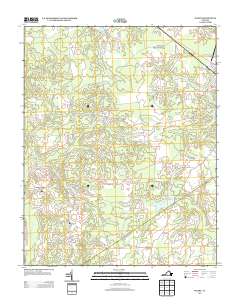
2013 Map of Manry
USGS Topo · Published 2013About this map
Manry and Piney Grove anchor this section of Southampton County, a landscape defined by an intricate network of wetlands and small agricultural settlements. The terrain is a mosaic of named marshes including Seacorrie Swamp, Big Woods Swamp, and Assamoosick Swamp, which have historically shaped the road patterns and land use of the region. The presence of Laniers Millpond, Brittles Millpond, and Mill Run Pond suggests a legacy of water-powered industry or managed drainage common in the Virginia Coastal Plain.
Find a feature on this map
57 named features on this map. Tap any name to fly to it.
Don’t see what you’re looking for? This feature index may not catch every label — zoom into the map to look around manually.
Map Details
Editions of this 2013 Manry Map
This is the sole edition of this map. No revisions or reprints were ever made.
Other maps of this area

1919 · Surry
USGS Topo · 1:62,500

1919 · Disputanta
USGS Topo · 1:62,500

1919 · Homeville
USGS Topo · 1:48,000

1920 · Ivor
USGS Topo · 1:62,500

1920 · Homeville
USGS Topo · 1:62,500

1943 · Sebrell
USGS Topo · 1:31,680

1943 · Manry
USGS Topo · 1:31,680

1943 · Littleton
USGS Topo · 1:31,680

1943 · Vicksville
USGS Topo · 1:31,680

1943 · Richmond
USGS Topo · 1:250,000