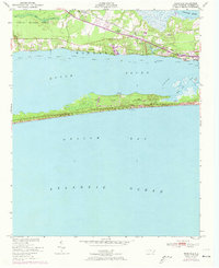
1951 Map of Mansfield
USGS Topo · Published 1973About this map
Bogue Sound serves as the central corridor of this coastal survey, separating the mainland settlements from the undeveloped reaches of Bogue Banks. On the northern shore, the Atlantic and East Carolina railroad connects the small communities of Wildwood and Mansfield, passing through the wooded margins of the Croatan National Forest and Hull Swamp. This map reflects the mid-century transition of the area toward seasonal recreation and maritime activity, evidenced by the presence of Camp Morehead, a Boys Camp, and a Golf Course near the Newport River. Along the sound, maritime infrastructure is prominent, with various daybeacons marking the Intracoastal Waterway and small docks at Willis Landing and Hoop Pole Landing providing access to the fishing grounds of Onslow Bay. The eastern edge captures the fringes of Morehead City and the localized settlement at Wallace.
Find a feature on this map
29 named features on this map. Tap any name to fly to it.
Don’t see what you’re looking for? This feature index may not catch every label — zoom into the map to look around manually.
Map Details
Editions of this 1951 Mansfield Map
2 editions found
Other maps of this area

1949 · Beaufort
USGS Topo · 1:24,000

1949 · Newport
USGS Topo · 1:24,000

1949 · Salter Path
USGS Topo · 1:24,000

1949 · Mansfield
USGS Topo · 1:24,000

1949 · Core Creek
USGS Topo · 1:24,000

1949 · Masontown
USGS Topo · 1:24,000

1951 · Salter Path
USGS Topo · 1:24,000

1951 · Newport
USGS Topo · 1:24,000

1951 · Core Creek
USGS Topo · 1:24,000
1951 · Peltier Creek
USGS Topo · 1:24,000