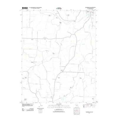
2011 Map of Mansfield NE
USGS Topo · Published 2011About this map
Hartville anchors the northern edge of this Ozark plateau landscape, where the Woods Fork Gasconade River winds through a series of deep hollows. The settlement pattern is defined by rural post offices and a high density of family-named cemeteries, reflecting a deeply rooted local genealogy. Small centers like Umpire, marked by the Umpire Post Office, serve as hubs for the surrounding farmsteads.
Find a feature on this map
75 named features on this map. Tap any name to fly to it.
Don’t see what you’re looking for? This feature index may not catch every label — zoom into the map to look around manually.
Map Details
Editions of this 2011 Mansfield NE Map
This is the sole edition of this map. No revisions or reprints were ever made.
Other maps of this area

1931 · Manes
USGS Topo · 1:48,000

1941 · Manes
USGS Topo · 1:62,500

1943 · Manes
USGS Topo · 1:62,500

1951 · Norwood
USGS Topo · 1:24,000

1951 · Owens
USGS Topo · 1:24,000

1951 · Mansfield NE
USGS Topo · 1:24,000

1951 · Mansfield NW
USGS Topo · 1:24,000
1951 · Mansfield
USGS Topo · 1:24,000
1951 · Cedar Gap
USGS Topo · 1:24,000

1951 · Mountain Grove
USGS Topo · 1:62,500