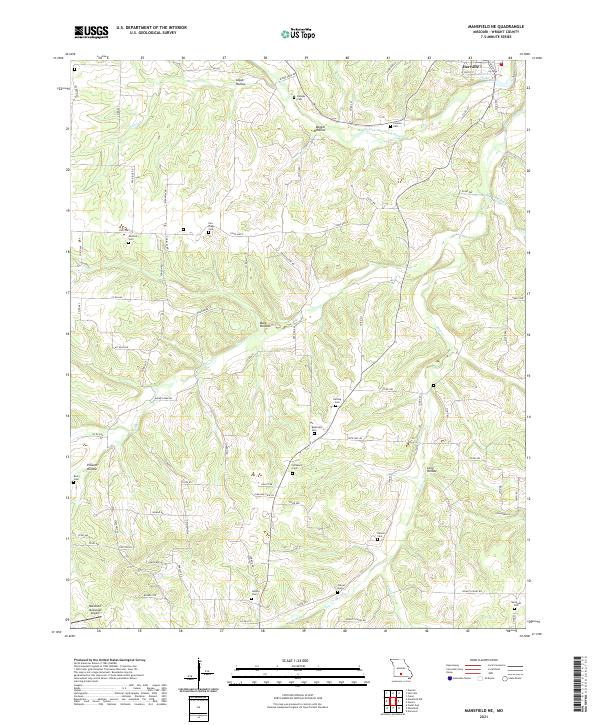
2021 Map of Mansfield NE
USGS Topo · Published 2021About this map
The Gasconade River and its tributary, the Woods Fork Gasconade River, carve through the Ozark plateau in this section of Wright County. The settlement of Hartville sits at the northern edge of the sheet, anchored by Casado Lake and a network of county roads that follow the high ridges. This landscape is defined by its deep drainage patterns, with named hollows such as Alsop Hollow and Possum Hollow providing relief to the timbered upland terrain.
Find a feature on this map
86 named features on this map. Tap any name to fly to it.
Don’t see what you’re looking for? This feature index may not catch every label — zoom into the map to look around manually.
Map Details
Editions of this 2021 Mansfield NE Map
This is the sole edition of this map. No revisions or reprints were ever made.
Other maps of this area

1931 · Manes
USGS Topo · 1:48,000

1941 · Manes
USGS Topo · 1:62,500

1943 · Manes
USGS Topo · 1:62,500

1951 · Norwood
USGS Topo · 1:24,000

1951 · Owens
USGS Topo · 1:24,000

1951 · Mansfield NE
USGS Topo · 1:24,000

1951 · Mansfield NW
USGS Topo · 1:24,000
1951 · Mansfield
USGS Topo · 1:24,000
1951 · Cedar Gap
USGS Topo · 1:24,000

1951 · Mountain Grove
USGS Topo · 1:62,500