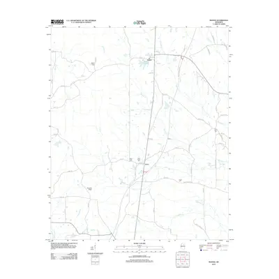
2012 Map of Mantee
USGS Topo · Published 2012About this map
Mantee and Dancy anchor this section of Webster County, situated within a landscape defined by the upper reaches of the Big Black River and its numerous tributaries. The geography here is a complex drainage network where Line Cr and Old Field Cr meander through the central plains toward the larger river system. For genealogists, the map is particularly useful for locating family burial sites across the rural countryside, including Mount Pleasant Cem, Wake Forest Cem, and Pisgah Cem. The prominent Choctaw Ridge rises in the southwest, providing a distinct topographical contrast to the low-lying basins of Johnson Cr and Flat Cr. The settlement pattern follows a grid of county roads that connect these small communities and isolated farmsteads, many of which are centered around Mantee Lake and the small hamlet of Sheba.
Find a feature on this map
63 named features on this map. Tap any name to fly to it.
Don’t see what you’re looking for? This feature index may not catch every label — zoom into the map to look around manually.
Map Details
Editions of this 2012 Mantee Map
This is the sole edition of this map. No revisions or reprints were ever made.
Other maps of this area

1953 · West Point
USGS Topo · 1:250,000

1958 · West Point
USGS Topo · 1:250,000

1959 · Van Vleet
USGS Topo · 1:62,500

1959 · Pheba
USGS Topo · 1:62,500

1963 · West Point
USGS Topo · 1:250,000

1972 · Maben
USGS Topo · 1:24,000

1972 · Atlanta
USGS Topo · 1:24,000

1972 · Sapa
USGS Topo · 1:24,000

1972 · Hohenlinden
USGS Topo · 1:24,000

1972 · Mantee
USGS Topo · 1:24,000